Most mountains become part of a journey. Hallasan does something more. It becomes an explanation for much of what travelers see around them.
On Jeju Island, it is difficult to remain indifferent to this mountain for long. It appears on the horizon during drives along the coast. It rises behind city neighborhoods. It accompanies roads that cross the island’s interior. Even when its summit is hidden by clouds, Hallasan’s presence can still be felt throughout the surrounding landscape.
That is why Hallasan is difficult to think of as just another attraction. It is not a place that people visit for a few hours before moving on. Quite the opposite. Many of Jeju’s most distinctive features become easier to understand once you begin looking at the island through the lens of its central volcano.
Not a Mountain on an Island, but an Island Around a Mountain
Many parts of the world have islands with prominent peaks. Jeju is different. The island itself was formed through volcanic activity, with Hallasan at its center. Over hundreds of thousands of years, repeated eruptions and lava flows created the foundation of the island, shaped its terrain, and gave it the form we see today.
Hallasan rises near the center of Jeju and influences the shape of the island far more than a map might suggest. Roads spread outward from its slopes. Elevation changes. Forests change. Weather patterns change. Even the many smaller volcanic hills scattered across the island are connected to the geological processes that once created this landscape.
Looking at satellite imagery, Jeju resembles a vast volcanic system. Seeing it in person is even more revealing. As you travel across the island, it becomes clear that Hallasan is not a separate feature within the landscape. It is the reason the landscape exists at all.
A Journey Through Several Worlds in a Single Day
One of the most remarkable aspects of climbing Hallasan has little to do with reaching the summit.
It has to do with the journey toward it.
The ascent gradually becomes a passage through different ecological zones. Dense forests dominate the lower sections of the trail. Higher up, temperatures become cooler, vegetation changes, and open terrain begins to appear. Farther above, the landscape grows harsher and windier.
Within only a few hours, travelers move through environments that elsewhere might require long journeys across several regions. It is not only the trees or the temperature that change. The character of the landscape changes as well.
For this reason, many visitors remember not just the summit, but the gradual transformation of one world into another as they gain elevation.
A Crater Lake at the Summit
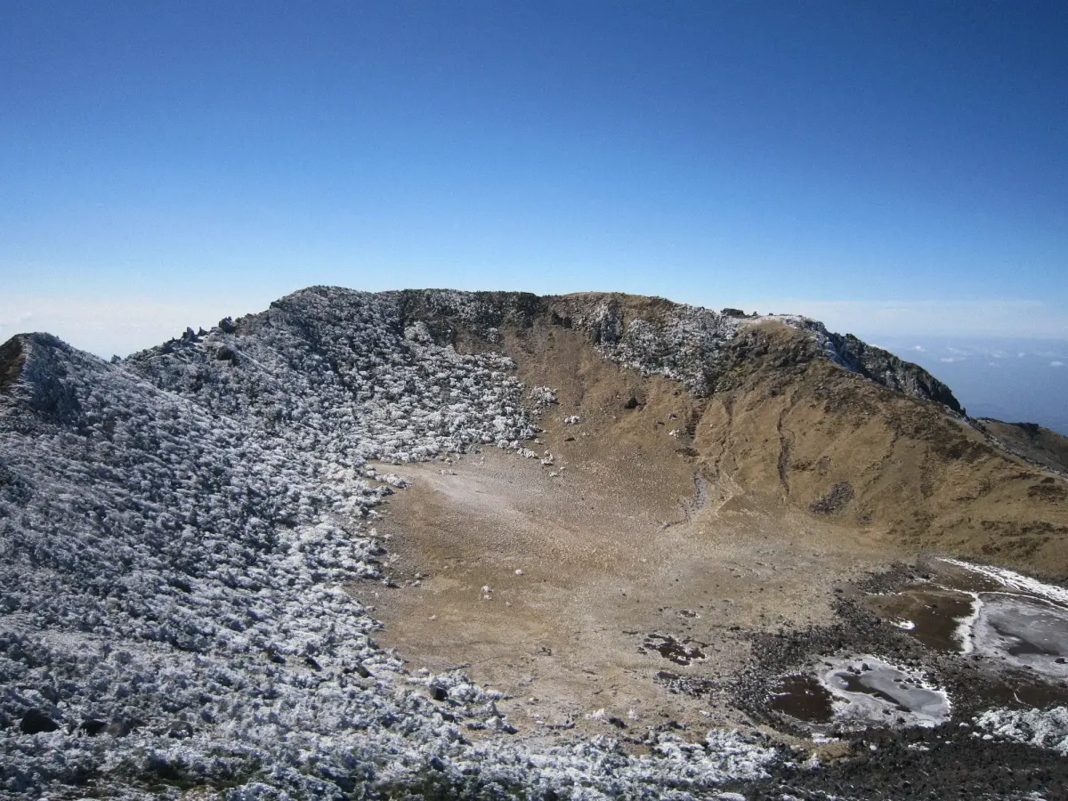
At the top of Hallasan lies Baengnokdam Crater.
Its name is often translated as “Lake of White Deer,” although seeing deer here today is unlikely. What visitors remember most is something else entirely.
After a long climb, the trail suddenly reaches the edge of a vast volcanic crater. At its center lies a lake whose appearance changes constantly depending on the season, rainfall, and weather conditions.
Sometimes the water appears almost motionless. At other times, clouds and fog sweep across the crater, transforming the scenery from one moment to the next. On clear days, views extend across much of Jeju Island.
It is here that the scale of the volcano becomes fully apparent. Until this point, Hallasan has felt like a mountain. From the summit, it becomes clear that it is an entire system that shaped the island itself.
A Mountain Visible from Almost Everywhere
On many islands, driving away from the center is enough for the mountains to disappear from sight.
Jeju works differently.
While traveling along the coastline, Hallasan repeatedly reappears between trees, houses, and rolling hills. At times it looks enormous and close. At others, it fades into the haze and becomes part of the distant horizon.
This creates an unusual effect. Even far from the national park, travelers remain connected to the mountain. It serves as a constant point of reference throughout the island.
Whether standing in a fishing village, driving along the coast, or exploring volcanic shorelines, the eye eventually returns to Hallasan.
The Volcano That Shaped All of Jeju
Even those who never climb the mountain encounter Hallasan again and again.
Its influence is present in the lava tubes for which Jeju is famous. It can be seen in the dark volcanic rock along the coast. It appears in the hundreds of smaller volcanic cones known as oreum. It affects the climate of different parts of the island and influences the distribution of vegetation.
Across Jeju, evidence of ancient eruptions can be found in places where visitors may not even realize they are looking at volcanic landscapes. Hallasan ceased being just a mountain long ago. It became the foundation of the island itself.
That is why experiencing Hallasan is not limited to visiting the national park. Its presence continues throughout almost every kilometer of travel across Jeju.
The Best Way to Discover Hallasan
Many travelers begin with the goal of reaching the summit. Yet Hallasan is far more than a hiking destination.
It is worth first seeing the volcano from a distance. Drive along the coast. Explore the oreum scattered across the island. Visit lava fields and volcanic cliffs. Watch the mountain appear and disappear on the horizon.
In that way, the climb becomes not a separate adventure but a natural continuation of understanding the island.
Gradually, it becomes clear that Hallasan is not simply the highest mountain in South Korea. It is the place around which an entire island was formed and one of the country’s most remarkable landscapes came into existence.